
The agricultural landscape is undergoing a technological revolution, with drones at the forefront of this transformation. These unmanned aerial vehicles are reshaping how farmers monitor crops, manage resources, and plan their operations. By providing unprecedented aerial perspectives and data collection capabilities, drones are enabling precision agriculture on a scale previously unimaginable. From high-resolution imaging to real-time analytics, the integration of drone technology is proving to be a game-changer for modern farming practices.
Precision agriculture revolution: drone technology integration
The integration of drone technology in agriculture marks a significant leap towards more efficient and sustainable farming practices. Precision agriculture, powered by drones, allows farmers to make data-driven decisions with pinpoint accuracy. This approach optimises resource use, reduces waste, and ultimately leads to increased crop yields and profitability.
Drones equipped with advanced sensors and cameras provide farmers with a wealth of information about their fields. This data includes soil composition, plant health, and even early signs of pest infestations or disease. By leveraging this information, farmers can apply inputs such as water, fertilizers, and pesticides precisely where and when they’re needed, rather than blanket-treating entire fields.
The adoption of drone technology in agriculture is not just a trend; it’s becoming a necessity for farms aiming to stay competitive in an increasingly challenging market. As you integrate these flying data collectors into your farming operations, you’ll find that they offer a level of detail and timeliness that traditional methods simply cannot match.
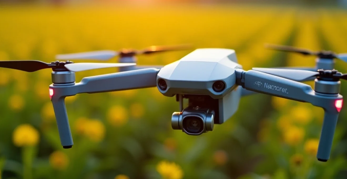
High-resolution aerial imaging for crop health assessment
One of the most significant advantages drones bring to agriculture is their ability to capture high-resolution aerial images of crops. These images provide invaluable insights into crop health, growth patterns, and potential issues that may not be visible from the ground. Let’s explore some of the cutting-edge imaging technologies that are making this possible.
Multispectral sensors and NDVI analysis in DJI phantom 4 multispectral
The DJI Phantom 4 Multispectral drone is revolutionizing crop health assessment with its advanced multispectral sensors. These sensors capture data across multiple spectral bands, including those invisible to the human eye. By analyzing this data, farmers can calculate the Normalized Difference Vegetation Index (NDVI), a key indicator of plant health and vigour.
NDVI analysis allows you to identify areas of stress in your crops before they become visible to the naked eye. This early detection capability is crucial for preventing yield loss and optimizing crop management strategies. With the Phantom 4 Multispectral, you can easily generate NDVI maps that highlight variations in crop health across your fields, enabling targeted interventions where they’re needed most.
Thermal imaging with FLIR vue pro R for irrigation management
Effective irrigation management is critical for maximizing crop yields while conserving water resources. The FLIR Vue Pro R thermal camera, when mounted on a drone, provides farmers with an powerful tool for assessing crop water stress and optimizing irrigation practices.
Thermal imaging detects temperature variations across your fields, which can indicate areas of water stress or irrigation system malfunctions. By identifying these issues early, you can adjust your irrigation strategies to ensure uniform water distribution and prevent crop damage due to over- or under-watering.
Lidar integration in AgEagle ebee X for topographic mapping
The AgEagle eBee X drone, equipped with LiDAR (Light Detection and Ranging) technology, offers unparalleled capabilities for creating detailed topographic maps of your farmland. LiDAR sensors emit laser pulses to measure distances to the ground, generating highly accurate 3D models of your terrain.
These precise topographic maps are invaluable for various aspects of farm planning, including:
- Optimizing drainage systems to prevent waterlogging
- Planning efficient irrigation layouts
- Identifying areas prone to erosion
- Calculating precise land area for crop planning
By leveraging LiDAR technology, you can make informed decisions about land use and resource allocation, ultimately improving your farm’s productivity and sustainability.
Hyperspectral imaging: headwall Nano-Hyperspec for nutrient deficiency detection
The Headwall Nano-Hyperspec sensor represents the cutting edge of crop health assessment technology. This hyperspectral imaging system captures data across hundreds of spectral bands, providing an unprecedented level of detail about your crops’ physiological state.
With hyperspectral imaging, you can detect subtle variations in plant chemistry that indicate nutrient deficiencies or other stress factors. This level of insight allows for highly targeted nutrient management, ensuring that your crops receive exactly what they need for optimal growth and yield.
Hyperspectral imaging is like giving your crops a comprehensive health check-up, revealing issues that would otherwise go unnoticed until they become severe problems.
Real-time data processing and AI-Driven farm analytics
The true power of drone technology in agriculture lies not just in data collection, but in the ability to process and analyze that data in real-time. Advanced computing systems and artificial intelligence are transforming raw drone footage into actionable insights that can guide your farm management decisions.
Edge computing with NVIDIA jetson xavier NX for On-Board processing
The NVIDIA Jetson Xavier NX is a game-changer for agricultural drones, bringing powerful edge computing capabilities to the field. This compact yet high-performance system enables on-board processing of complex data, reducing the need for constant data transmission and allowing for real-time decision-making.
With edge computing, your drone can perform tasks such as:
- Real-time crop health analysis
- Immediate detection of pest infestations or disease outbreaks
- On-the-fly adjustments to flight paths for optimal data collection
- Instant generation of NDVI maps for rapid assessment
By processing data on-board, you can make quicker, more informed decisions about your crops, potentially saving valuable time and resources in critical situations.
Machine learning algorithms for crop yield prediction
Machine learning algorithms are revolutionizing crop yield prediction by analyzing vast amounts of data collected by drones. These algorithms can identify patterns and correlations that human analysts might miss, providing more accurate yield forecasts and helping you plan your harvest more effectively.
By incorporating historical yield data, weather patterns, soil conditions, and real-time crop health information, these AI-driven systems can:
- Predict yield variations across different areas of your fields
- Identify factors contributing to yield discrepancies
- Suggest interventions to improve underperforming areas
- Optimize harvest timing for maximum yield and quality
As you integrate these predictive tools into your farm management strategy, you’ll be better equipped to make data-driven decisions that maximize your farm’s productivity and profitability.
Dronedeploy’s live map technology for instant field insights
DroneDeploy’s Live Map technology is transforming how quickly you can access and act on drone-collected data. This innovative feature generates real-time maps of your fields as the drone flies, providing instant insights without the need for time-consuming post-processing.
With Live Map, you can:
- Identify problem areas in your fields immediately
- Make on-the-spot decisions about crop management
- Share real-time information with your team for coordinated action
- Reduce the time between data collection and implementation of solutions
This rapid feedback loop enables you to respond to crop issues more quickly and efficiently, potentially preventing significant losses and optimizing your farm’s performance.
Integration with john deere operations center for comprehensive farm management
The integration of drone data with comprehensive farm management platforms like the John Deere Operations Center represents a significant step towards fully integrated precision agriculture. This seamless data flow allows you to combine drone-collected insights with other critical farm data, creating a holistic view of your operations.
By connecting your drone data to the Operations Center, you can:
- Overlay aerial imagery with equipment data for optimized field operations
- Create variable rate prescriptions based on drone-generated maps
- Track the effectiveness of interventions over time
- Streamline record-keeping and compliance reporting
This level of integration ensures that the valuable data collected by your drones is fully leveraged across all aspects of your farm management, driving efficiency and profitability.
Automated flight planning and precision spraying systems
Automated flight planning and precision spraying systems are revolutionizing how farms manage their crops and resources. These advanced drone technologies not only save time and labour but also significantly improve the accuracy and efficiency of crop treatments.
DJI agras T30 VLOS and BVLOS operations for Large-Scale farms
The DJI Agras T30 represents a significant advancement in agricultural drone technology, capable of both Visual Line of Sight (VLOS) and Beyond Visual Line of Sight (BVLOS) operations. This versatility makes it an ideal solution for large-scale farms where efficiency and coverage are paramount.
Key features of the Agras T30 include:
- A 30L spray tank for extended operation
- Advanced obstacle avoidance systems for safer flights
- Precise RTK positioning for accurate spraying
- Automated flight planning for consistent coverage
With BVLOS capabilities, you can cover vast areas of your farm without the need for constant repositioning, significantly increasing the efficiency of your spraying operations. This technology is particularly valuable for farms with challenging terrain or widely dispersed fields.
Variable rate application using PrecisionHawk’s algorithm suite
PrecisionHawk’s advanced algorithm suite takes precision agriculture to the next level by enabling variable rate application of inputs. This technology allows you to apply fertilizers, pesticides, or other treatments at varying rates across your fields based on the specific needs of different areas.
The benefits of variable rate application include:
- Optimized use of inputs, reducing waste and costs
- Improved crop health and yield through targeted treatments
- Minimized environmental impact by avoiding over-application
- Enhanced compliance with regulations through precise application records
By leveraging PrecisionHawk’s algorithms, you can create highly detailed prescription maps that guide your drone’s spraying patterns, ensuring that each part of your field receives exactly what it needs for optimal growth and health.
Regulatory compliance and data security in agricultural drone operations
As drone technology becomes more prevalent in agriculture, understanding and adhering to regulatory requirements is crucial. Additionally, ensuring the security of the vast amounts of data collected by these systems is of paramount importance.
FAA part 107 certification and waivers for agricultural drone pilots
Operating drones for commercial agricultural purposes in the United States requires compliance with the Federal Aviation Administration’s (FAA) Part 107 regulations. As a farm operator or drone pilot, you must obtain a Remote Pilot Certificate and adhere to specific operational guidelines.
Key aspects of FAA Part 107 compliance include:
- Passing the aeronautical knowledge test
- Registering your drone with the FAA
- Following flight restrictions and airspace regulations
- Maintaining visual line of sight during operations
For operations that fall outside standard Part 107 rules, such as night flights or BVLOS operations, you may need to apply for waivers. These waivers allow for expanded drone use in agricultural settings, provided you can demonstrate adequate safety measures.
GDPR and CCPA compliance in farm data management
As you collect and process vast amounts of data through your agricultural drone operations, it’s essential to consider data protection regulations such as the General Data Protection Regulation (GDPR) in the European Union and the California Consumer Privacy Act (CCPA) in the United States.
Key considerations for compliance include:
- Implementing robust data security measures
- Obtaining necessary consents for data collection and processing
- Providing transparency about data usage and storage
- Ensuring the right to access and delete personal data
By prioritizing data protection compliance, you not only avoid potential legal issues but also build trust with stakeholders and protect your farm’s valuable information assets.
Blockchain technology for secure and transparent data sharing
Blockchain technology is emerging as a powerful tool for ensuring the security and transparency of agricultural data. By creating an immutable, decentralized record of data transactions, blockchain can provide a secure framework for sharing and verifying farm data collected by drones.
Benefits of implementing blockchain in agricultural data management include:
- Enhanced traceability of farm products from field to consumer
- Secure sharing of data with stakeholders such as insurers or regulators
- Prevention of data tampering or unauthorized access
- Creation of verifiable records for compliance and certification purposes
As you integrate blockchain into your farm data management practices, you’ll be at the forefront of secure and transparent agricultural data sharing, potentially opening up new opportunities for collaboration and value creation.
Economic impact and ROI analysis of drone implementation in farming
The adoption of drone technology in agriculture represents a significant investment, but one that can yield substantial returns when implemented effectively. Understanding the economic impact and conducting thorough ROI analyses are crucial steps in making informed decisions about integrating drones into your farming operations.
Key factors to consider in your ROI analysis include:
- Initial equipment and training costs
- Ongoing maintenance and operational expenses
- Potential savings in labour and resource costs
- Increased yields through improved crop management
- Reduced losses from early detection of issues
Studies have shown that drone technology can lead to significant improvements in farm productivity and profitability. For example, a report by PwC estimated that the market for drone-powered solutions in agriculture could reach $32.4 billion globally. This indicates the massive potential for economic impact that drones bring to the agricultural sector.
When calculating ROI, it’s important to consider both immediate and long-term benefits. While some advantages, such as reduced labour costs for crop scouting, may be immediately apparent, others, like improved soil health through more precise input application, may take several seasons to fully materialize.
Additionally, the scalability of drone technology means that as your operation grows, the relative cost of drone implementation often decreases, potentially leading to even greater ROI over time. As you integrate drones into your farming practices, regularly assessing their economic impact will help you optimize their use and maximize your returns.
The true value of drone technology in agriculture lies not just in the data it collects, but in how that data is translated into actionable insights that drive profitability and sustainability.
As drone technology continues to evolve, its impact on agriculture is only set to grow. From enhancing crop monitoring and management to streamlining operations and improving decision-making, drones are playing a crucial role in shaping the future of farming. By staying informed about the latest developments and carefully considering how these technologies can benefit your specific operation, you’ll be well-positioned to leverage drones for improved farm surveillance and planning, ultimately driving your agricultural business towards greater success and sustainability.